
Land north of the A370 (Farleigh Road), Backwell
Relief Road
A large proportion of the feedback from our public consultation identified the relief road as an essential piece of new infrastructure that must be delivered if the proposals do go ahead. Similarly, the transport evidence base for the emerging North Somerset Local Plan identifies a future requirement for the relief road, connecting the A370 with Station Road and avoiding the Backwell crossroads.
The proposed development would deliver an access road to serve the site, which is designed to later become the south-eastern section of the relief road, connecting to the A370 via a signal-controlled junction as envisioned by North Somerset Council. The remaining section of the relief road would pass through land not within our control and would therefore have to be delivered by other parties.
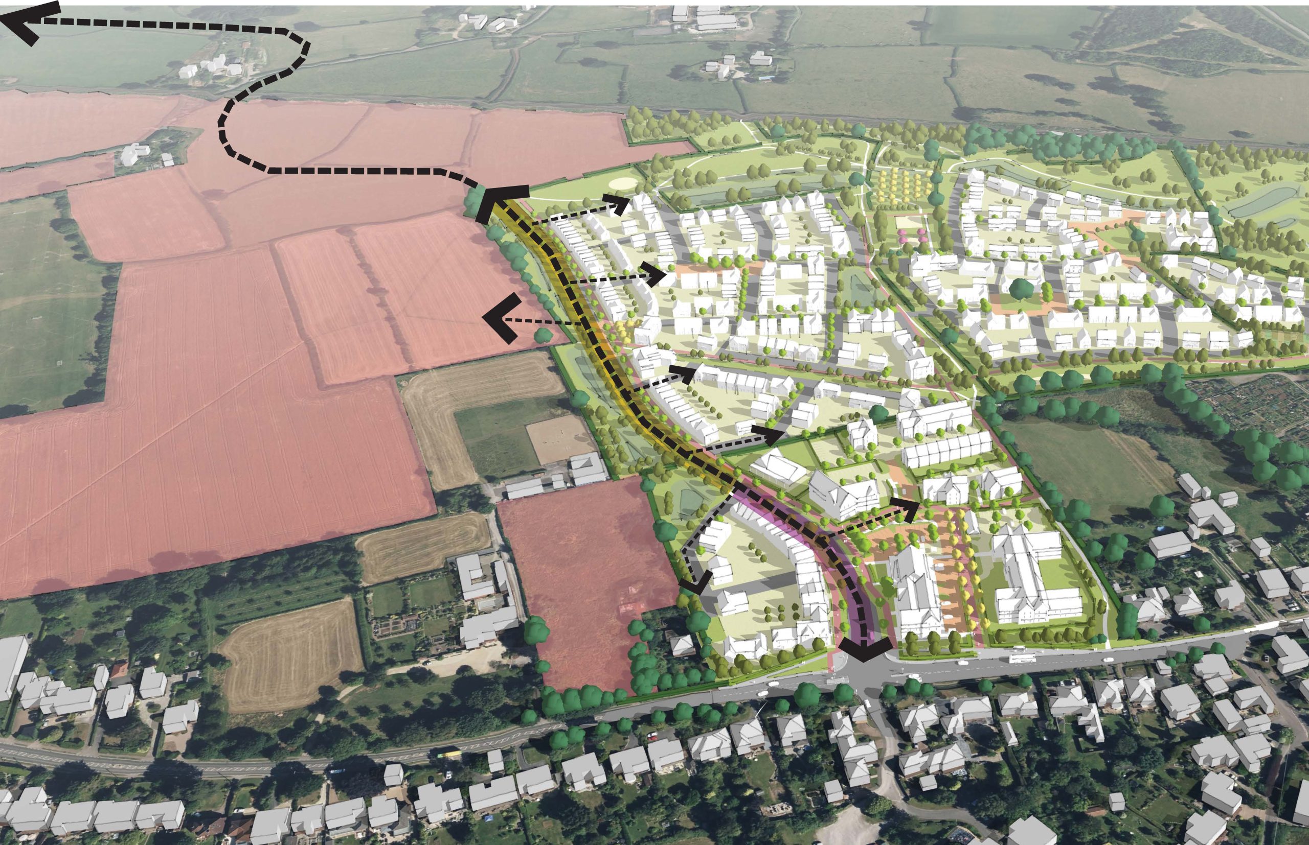
An annotated 3D view showing the route of the relief road through the site and beyond
Although the completion of the relief road is beyond our control, the proposals for this site have been designed to directly enable the delivery of one-third of the relief road, from the new junction on the A370 through the site up to its north-western corner. To make the delivery of this part of the relief road as straightforward as possible, the following design considerations have been taken into account:
- The road has been routed up the western side of the site to allow for the shortest and most direct connection into the adjoining allocated land to the north, with flexibility for additional connections to the west as needed.
- The road has been designed to the specification of a ‘Neighbourhood Distributor Road’ (NDR), as requested by North Somerset Council. It is intended to act as a 30 mph highway route, with a carriageway width of 7.3 metres suitable for HGVs and buses. There will be no direct frontage or driveway access from this road.
- The road has also been designed to serve a strategic multi-modal function, in line with the ambitions of North Somerset Council. As well as being designed to serve as a future bus route, the road has been designed to provide a pedestrian and cycle pathway along its entire eastern side, separated from the carriageway by a tree planted verge. This will ultimately provide an attractive Active Travel route up to Nailsea and Backwell Station, avoiding Station Road which has only narrow footways and no cycle infrastructure.
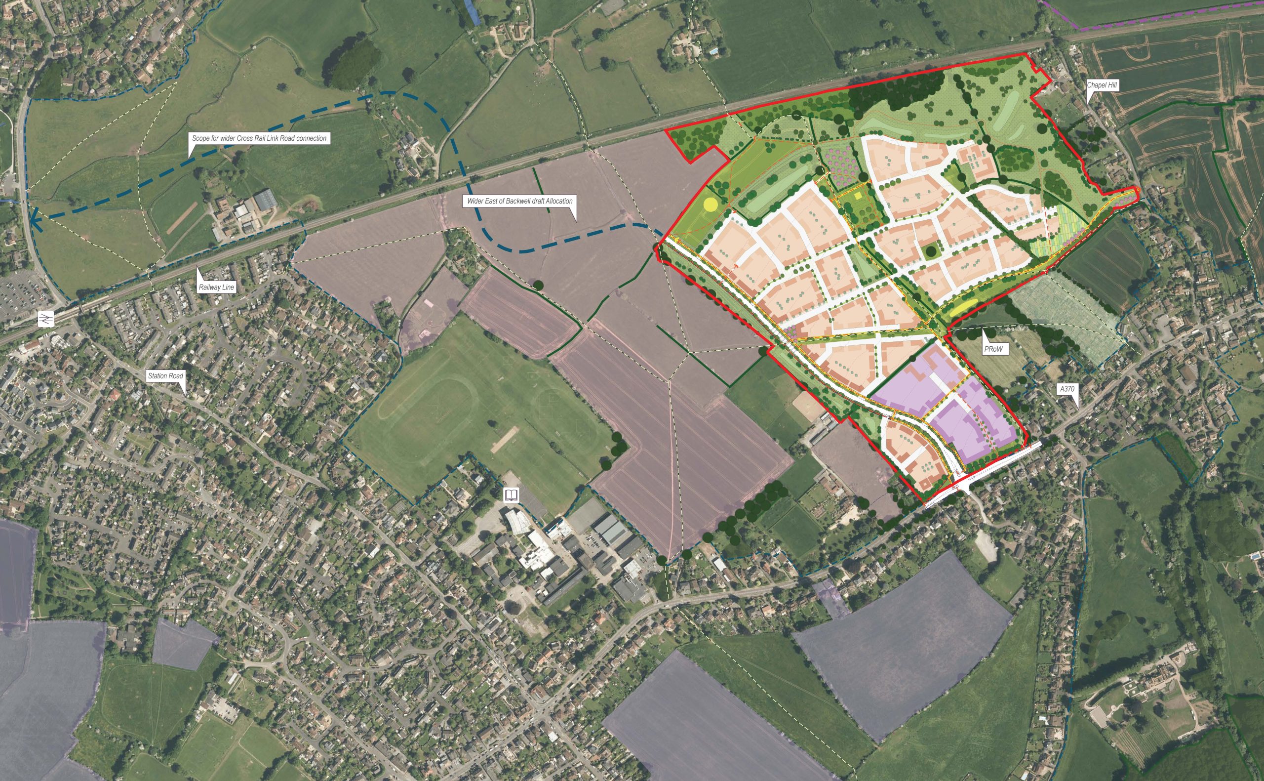
An image showing a potential route for the relief road beyond the site, towards Nailsea and Backwell Station
Contact Us
If you have any queries, please contact Jamie O’Sullivan of SP Broadway on
07706 274 637 or at jamie@spbroadway.com